
Antigua Guatemala was the capital of Spain's Captaincy General of Guatemala for more than two centuries, governing much of Central America from a highland valley surrounded by volcanoes. In 1773 a series of earthquakes ruined much of the city, and the capital was moved to a new site, today's Guatemala City. Antigua was never entirely abandoned, but many of its churches and convents were left as ruins, and the town that grew back among them is now one of the best preserved colonial cities in the Americas. It was listed as a UNESCO World Heritage Site in 1979.
The town is laid out on a regular grid of cobbled streets, with low, brightly painted houses behind long walls and heavy wooden doors. It is small: you can cross it on foot in twenty minutes. But it rewards slow walking, and the best way to see it is to wander, with a few fixed points to aim for.
Parque Central and the cathedral
Start in Parque Central, the main square, shaded by trees and busy from early morning. The fountain in the middle, with its figures of mermaids, is the usual meeting point. On the east side of the square stands the Cathedral of San José. Only the front part is in use as a church; behind it, the vast ruins of the earlier cathedral stretch back under the open sky, with fallen domes and broken arches. On the south side, the long arcaded Palace of the Captains General was the seat of colonial government.
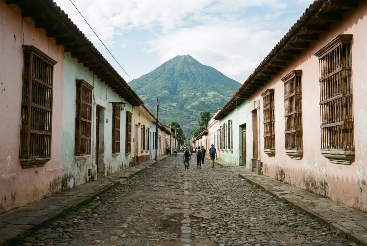
Look up from the square on a clear morning and you will see the Volcán de Agua, a perfect cone rising south of the town. To the west, its neighbours Acatenango and Fuego stand side by side; Fuego is one of the most active volcanoes in Central America, and on many days you can see it smoking.
The arch and La Merced
Walk north along Fifth Avenue, the most photographed street in town, to the Arch of Santa Catalina. It was built in the late 17th century so that nuns of the convent behind it could cross the street without being seen, and the clock on top was added later. With the Volcán de Agua framed beneath it at the end of the street, it has become the symbol of the town.
Look up from the square on a clear morning and you will see the Volcán de Agua, a perfect cone rising south of the town.
A few blocks further north stands the church of La Merced, with a yellow facade covered in white stucco decoration that looks almost like icing. It survived the earthquakes better than most, and its ruined convent next door has one of the largest fountains in Central America in its cloister.
A NOTE THAT FITS THE SAME TRIPAntigua to Santa Ana and El Tunco by roadThe ruins of the churches
Antigua is full of ruined churches and convents, and visiting two or three of them is the heart of a stay. Some are open, roofless spaces where you can walk among the fallen masonry and stand in old cloisters; others have been partly restored. The Convent of the Capuchins has an unusual round cloister of nuns' cells. San Francisco church, on the south-east side of town, is still in use and holds the tomb of Brother Pedro, a 17th-century friar who cared for the poor and is the country's first saint. The ruins behind the main cathedral are among the most dramatic of all.
Cerro de la Cruz
For a view over the whole grid, walk north-east to the stairs and path that climb Cerro de la Cruz, a hill with a large stone cross above the town. The climb takes about 20 minutes. From the top, the town spreads out below with the Volcán de Agua behind it. The path is best walked in daylight and with company.
Seasons and practical notes
The dry season, from about November to April, brings clear mornings and the best volcano views. Semana Santa, the week before Easter, is the busiest and most remarkable time to visit: processions move through the streets over carpets of coloured sawdust, flowers and fruit laid out by local families. Book well ahead for that week. The rainy season usually brings sunny mornings and heavy afternoon showers.
- The cobbles are uneven and the pavements narrow; wear proper shoes.
- Antigua sits at about 1,500 metres. Evenings are cool for much of the year.
- Volcano hikes are popular but conditions change.
- The usual way on is south-east towards El Salvador; see our notes on the road to Santa Ana and El Tunco, or north to the Maya city of Tikal.